
The trails surrounding the town of Kodiak Alaska, for the most part, have been developed and maintained by local hikers and organizations. All the trails can be done in a day however many have great opportunities for backcountry camping as well.

Although we brought the standard USGS topo maps we found the best map and trail guide was the Audubon’s map, printed on waterproof paper, that was available at all the local shops and visitors center. The Kodiak Audubon has guided weekly group hikes as well.

We did not have enough time to hike all the trails Kodiak had to offer, wish we did, so we tried to choose ones that would be representative of the island’s ecology summit to sea.
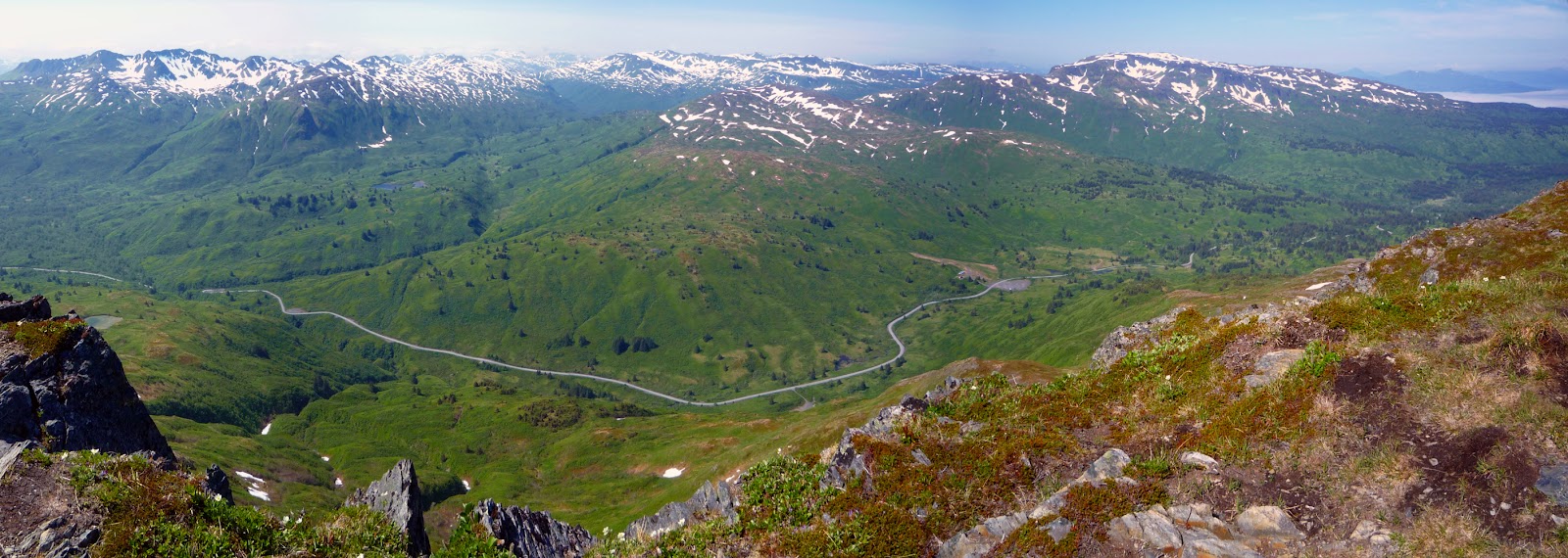
Pyramid Mountain
We first glimpsed Pyramid Peak while kayaking in Chiniak Bay and its symmetrical shape and commanding height made it a very appealing objective. Later when we learned that a trail went to the summit we vowed to make the climb, if the weather gods would allow. The trail climbs 2,400 feet and is 4 miles round trip.

This trail is only for the sure footed as the final scramble to the summit is steep and exposed.

For Brenda and I however the trek was worth the effort to see Kodiak Island and its mountains from above. Northern Panorama

Southern Panorama
Pasagshak and Narrow Cape
This group of trails is mostly coastal overlooking Ugak Bay and the Gulf of Alaska and runs along high cliffs and mostly treeless terrain. The trail starts at the end of the Pasagshak Road and is within sight of the Alaska Aerospace Launch Complex. 8 miles round trip

This group of trails is mostly coastal overlooking Ugak Bay and the Gulf of Alaska and runs along high cliffs and mostly treeless terrain. The trail starts at the end of the Pasagshak Road and is within sight of the Alaska Aerospace Launch Complex. 8 miles round trip

June is spring time on Kodiak Island and the wild flowers were in full bloom.

Introduced buffalo made an unusual and interesting sight along our path and this mom and her calf didn’t seem to mind our presence. Lucky us, they’re huge!
 Looking for gray whales
 Termination Point Loop Trail
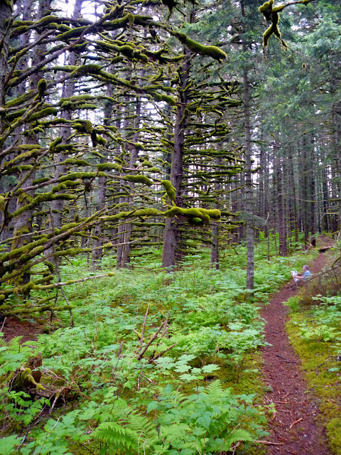
At the northern end of the road system the Termination Point Trail wonders through a mossy Sitka Spruce forest, coastal meadows and beaches to an overlook of Monashka Bay. 5 miles round trip

Large trees like these only occur on the northern half of the island along the coast.
Cape Chiniak
The Chiniak Highway stops just a few miles short of the far eastern end of the island, here a foot and ATV trail continue to the very end and offers superb wildlife viewing along the way. Dozens of spices of birds, including both tufted and horned puffins inhabit the rocky islands and outcroppings of the coastline. 6 miles round trip


At the northern end of the road system the Termination Point Trail wonders through a mossy Sitka Spruce forest, coastal meadows and beaches to an overlook of Monashka Bay. 5 miles round trip

Large trees like these only occur on the northern half of the island along the coast.

Cape Chiniak
The Chiniak Highway stops just a few miles short of the far eastern end of the island, here a foot and ATV trail continue to the very end and offers superb wildlife viewing along the way. Dozens of spices of birds, including both tufted and horned puffins inhabit the rocky islands and outcroppings of the coastline. 6 miles round trip
As the land rose it created this lake and natural causeway between fresh and salt water.

During the Second World War dozens of bunkers and heavy gun emplacements were constructed along this coast to defend the town of Kodiak and its airfield.
 Once built to watch for enemy ships today they are a great retreat to watch for passing Gray Whales on their yearly migration.


"Time is but the stream I go a-fishing in. Its thin current slides away, but eternity remains.”
– Henry David Thoreau