

Alaska
Highway 1
The Yukon section of the Alaska Highway, aka Alcan Highway, travels over 940 km (584 mi) from the B.C. / Yukon
border near the town of Watson Lake to the Alaskan border just past the village
of Beaver Creek. For many visitors Watson Lake is their first stop in the Yukon
and a chance to resupply and get information on the road ahead. The Watson Lake Visitor Center was well worth the stop not only for the excellent information
that the staff provided but also to view the small museum on the construction of the Alaska Highway during World War II. While we were in Watson Lake Brenda
and I walked the Wye Lake Trail to look for birds resting up on their fall
migration south. The Alaska Highway is well paved but like many parts of the
Yukon’s road system opportunities for getting gas are few and far between. We
learned that many of the remote gas stations in the Yukon that are listed on
brochures and maps have since gone out of business. In planning out trip we had
to make sure that we had enough fuel to get where we were going and to carry
extra if needed.

After leaving Watson Lake we passed
over the Liard River and through the Kaska First Nation village of Upper Liard.
This stretch of highway follows along the Rancheria River to the Continental
Divide and then along the Swift River towards the Tlingit First Nation village
of Teslin. Just before entering this small community the highway crosses the Nitsutlin
Bay Bridge, at 584 meters it is the longest bridge located on the Alaskan
Highway. As a stop along the way, or a final destination, Teslin has good food, lodging, a museum and outstanding outdoor recreation to recommend it.

Just north of the town of Teslin we stopped to visit the Teslin Tlingit Heritage Center to learn more about the history and culture of the people who live in this remarkable place. Located along the shore of the 120 km (75 mi) long Teslin Lake, the Heritage Center has many interesting exhibits along with cultural demonstrations, workshops and traditional gatherings. We were especially intrigued by their beautifully panted northwest coast style canoes that sat poised to travel on the waters of this splendid lake.

Located midway along the Alaska
Highway, the Whitehorse area has the most extensive trail system the territory.
With a 150 km (93 mi) of trails that are maintained by the city and an estimated
700 km (435 mi) of local and neighborhood trails this scenic area has everything
from intercity walks that meander along points of historical interest to rugged
backcountry trails that lead into the surrounding mountains. A great way to see
wildlife, on one outing we observed this Red Fox just barely miss his midday
meal. Oh well, it probably was a tough old squirrel anyway.


The City of Whitehorse, population
12,300, is the territorial capital of the Yukon. Located along the banks of the
Yukon River the city offered us way too much to see and do during our short
stay. Besides some great restaurants and a vibrant arts and cultural scene
there was the opportunity to peruse the shelves of Mac’s Fireweed Books to search
for some interesting winter reading material and also purchase several maps for
future expeditions. Then it was off to the Beringia Interpretive Centre to
learn about the prehistoric creatures and early humans that inhabited the Yukon
during the last Ice Age. Later on we visited the Yukon Transportation Museum
and the MacBride Museum to view exhibits on the transportation, mining
technologies and lifestyle of the early pioneers. We were amazed to learn that
there had at one time been a fleet of over 300 riverboats that plied the waters
of the Yukon River and its tributaries. Close to the downtown area the S.S. Klondike,
restored to her original 1937 appearance, pays tribute to a bygone era of
riverboat transportation that linked Whitehorse and the Yukon to the outside
world before the construction of the Alaska Highway.

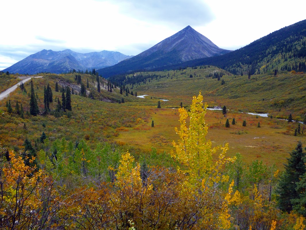
From Whitehorse the highway continued west passing side roads that lead to Kusawa and Aishihik Lakes, both located in the Champagne and Aishihik First Nations traditional territory. At the town of Haines Junction we stopped in at the Kluane National Park and Reserve visitor center to find out about the parks extensive trail system and arrange backcountry permits. This spectacular region that encompasses the highest mountain ranges in Canada is easily our top choice when it comes to hiking in the Yukon. From Haines Junction the highway turned northwest and we followed along Kluane Lake, traditional territory of the Kluane First Nation, and stopped for the night at the tiny outpost of BurwashLanding home of the Kluane Museum of Natural History. From there it was a long but scenic drive around the northern end of the Park before we arrived at the community of Beaver Creek, home to the White River First Nation, and the Yukon / Alaska border.
Klondike Highway 2
The Klondike Highway is 705 km (438 mi)
long and completely paved. It began at tidewater in the historic town of
Skagway Alaska where the road and the historic railroad crossed over scenic
White Pass to the town of Carcross in the Yukon. From there the highway
continued on north through Whitehorse, Carmacks and up into the Northern Yukon.
The quaint little community of Carcross, situated in the heart of the Southern Yukon Lakes area, offered many outstanding outdoor recreation opportunities
including boating, fishing and camping. On this trip we took a friend’s advice
and hiked up the Caribou Mountain Trail and made camp overlooking the Carcross
area and Lake Bennett.

Haines
Road 3
The Haines Road is 66 km (41 mi) long and completely paved. We started
in the lovely seaport town Haines Alaska and traveled over a beautiful high
mountain pass to the town of Haines Junction in the Yukon. The first part of
the road traversed the Chilkat River Valley, a large braided river that is part
of the Chilkat Eagle Preserve established to protect the world's largest
concentration of Bald Eagles and their critical habitat. During the late fall
and early winter this unique stretch of river remains unfrozen and supports an
extended salmon run that attracts over three thousand eagles and coincides with
the yearly Alaska Bald Eagle Festival held in November. Above the river the
glacier incrusted Takhinsha Mountains provides a stunning backdrop to this
amazing spectacle. As the road passed the Canadian border it gained elevation
between the northern end of the Coast Mountains and the southern end of the Saint Elias Mountains. As the road descended toward Haines Junction it skirted the
eastern edge of Kluane National Park and Preserve that is crowned by two of the
highest mountains in Canada, Mount Logan at 5,959 m (19,551 ft) and Mount Saint
Elias at 5,489 m (18,008 ft).

Robert
Campbell Highway 4
The Robert Campbell Highway is a 613
km (381 mi) mostly dirt two lane road that winds its way from the town of
Watson Lake located along the Yukon / B.C. border to the town of Carmacks in
the central Yukon. This road is far less crowded and a more rustic alternative
to the Alaska Highway when heading north into the Yukon. Another plus is the number
of streams, rivers and lakes along this highway that have excellent fishing. Our
first stop, Frances Lake, was of particular interest to us, it being the
largest lake along the highway as well as an area of biological and historical
significance. The explorer Robert Campbell built the first trading post in the
Yukon near the southern end of the lake in 1842 the remains of which are still
visible today. An important hunting and fishing area for the Kaska First Nation,
the lake and surrounding area are one of the most biologically productive areas
in the Yukon. While fishing along the lake’s western shore Brenda and I paused
to admire the classic lines and workmanship of this handcrafted riverboat.

Continuing north the highway follows
the Tintina Trench a large geological fault line that shapes the wide valley that
surrounds the Pelly River. We stopped in at the town of Faro that bills itself
as “Yukon’s best kept secret” to hike a few of its trails and survey the area’s
natural and historic highlights. While we were there we kept an eye out for
flocks of Sandhill Cranes that pass through on their yearly migration and paid
a visit to the Mount Mye Sheep Center to scan the rocky slopes of Mount Mye for
a glimpse of the rare Fannin Sheep.


Canol
Road 6
The strategic importance of the Northwest during the Second World War
prompted the U.S. Army to begin construction of an oil pipeline and roadway from
Norman Wells in the Northwest Territories to the city of Whitehorse in the
Yukon. The Canol (Canadian Oil) project was completed in two years at a price
of $134 million dollars. In the end the perceived threat to the Northwest Coast
never materialized and the project was deemed a great waste of time and money.
Thankfully the Yukon government has wisely continued to maintain the road to
the border of the N.W.T. thus allowing access to some of the most remote and
beautiful parts of the Yukon. The South Canol Road stretches 225 km (139 mi)
from Johnsons Crossing on the Alaskan Highway to the village of Ross River just
past the Robert Campbell Highway. It is a seasonal two lane dirt road with no
services that is usually in good condition. At first the road followed alongside
the Nisutlin River and Quite Lake before entering the Pelly Mountains where it
traversed the Rose and Lapie River drainages. Along the way we would
occasionally catch a glimpse of discarded vehicles and structures from the
ill-fated pipeline project.

During this road trip Brenda and I continued
to learn a bit more about the ecology of the Boreal Forest and how the
succession of plants, animals and insects evolves after a forest fire. Fires
are frequent in the southern Yukon and their influence at all levels drives
forest vegetation dynamics. This in turn affects the movement of wildlife
populations that must relocate as forest patterns and available food species change.
There is even a cool scientific name for this ecological mechanism “pyrodiversity”.
There are of course other factors that determine the type of plants that grow
in this region, elevation, weather patterns, subsurface hydrology and depth of
permafrost, but fire and the time that has passed since the last burn is the
dominate factor in the types of species that exist in any given area. As we drove
along we would try and guess the length of time since the last burn by the
types of trees and plants that we would see in any given area.
The North Canol Road runs 249 km (166 mi) from the Kaska First Nation village of Ross River to the N.W.T border in the Selwyn Mountains. It is a seasonal one lane dirt road without services that is usually in poor condition, though better than we had been led to believe. This adventuresome road starts by driving aboard the miniature George Black Ferry that crosses the Pelly River and then winds its way across the broad Yukon Plateau. After many hours of driving we arrived at Dragon Lake located below Mount Sheldon before making camp for the evening. There were no designated campgrounds located on the North Canol Road but we found numerous side roads and pull offs that were used by folks for camping.

As we traveled along the Canol Road it
was clear that the fall moose and caribou hunt was in full swing. Campsites
were crowded with hunters in camouflage clothing and pickup trucks with
dismembered carcasses were returning home to the freezer or smokehouse. Traditional
hunting and gathering continues to be an important part of the northern economy
for many Yukon families, especially for those who live in remote villages, and
these fall activities will provide much needed food and sustenance for the long
winter months ahead. Most modern hunters arrived with RVs and ATVs to conduct
this seasonal harvest but some still continued to use the tried and true
methods of the past, staying in a cabin or wall tent and hunting by foot, canoe
or horseback.

The road continued to wind its way up into the Selwyn Mountain Range and eventually to parallel the south fork of the Macmillan River. As we approached Mount Itsi with its small hanging glacier we were stopped by a road crew at the Macmillan River Bridge. The bridge was under repair and would be closed for several weeks, darn! It was a bit of a disappointment to be turned around only fifty or so kilometers from our goal of reaching the high pass and the N.W.T. border. We had planned to hike a short stretch of the Canol Heritage Trail located on the other side of the pass but instead consoled ourselves by having lunch near the river and taking in the grand vistas of the surrounding mountains. “Oh well, perhaps another day” we lamented. On the way back down we speculated on the condition of the bridge and what may have awaited us had we been allowed to continue on?

Atlin
Road 7
The Atlin Road is a well maintained two lane dirt road that starts at
Jakes Corner and drops south 98 Km (58 mi) through the
traditional lands of the Taku River Tlingit to the isolated town of
Atlin in British Columba. The name Atlin comes from the Tlingit word Áa Tlein that
describes the beautiful 101 km (68 mi) long glacier-fed lake that parallels the
road. The current population of Atlin is 300 to 500
full-time residents but during the Gold Rush of 1898 the population was over 10,000!
Today a fair number of the old buildings are still standing and many artists
and musicians call this charming community home. They even host a small, but
enthusiastically attended Arts and Music Festival there in the summer. Charming
and picturesque the town alone is well worth the drive down and back but Atlin
also serves as the gateway to the magnificent Atlin / Téix’gi Aan TleinProvincial Park located along the southern end of Atlin
Tagish
Road 8
The Tagish Road is a 53 Km (33 mi)
paved two lane side road that connects Jakes Corner and the town of Carcross. It
is also the main access road to the Carcross Tagish First Nation community of
Tagish. It was a short but scenic drive and along the way Brenda and I stopped
for dinner at the 6 Mile River Resort located on the short stretch of river
that connects Tagish and Marsh Lakes. The food was really excellent and the
resort, that had kayaks and canoes to rent, looked like it would have been a fun
place to stay if we had had more time.
Nahanni
Range Road 10
The Nahanni Range Road is a 201 km (125 Mi) well maintained two lane
dirt road that starts at the road maintenance camp of Tuchitua on the Robert
Campbell Highway and penetrates the southern end of the Selwyn Mountains to a
active mine site a few kilometers past the N.W.T. border. There was one provincial
campground along the way as well as numerous side roads and pull offs that
accessed quiet lakes and streams for camping and fishing. For us this drive was
one of the most scenic and beautiful in the Yukon but we had be to alert and
ready to give way to the large ore trucks that were heading in and out of the
mine.

As the road climbed steadily higher it traversed along the Hayland River before breaking out of the trees and into the open arctic tundra. This vast open country presented an excellent opportunity to bring out the binoculars and look for the Nahanni Caribou Herd that spends its summers browsing on the surrounding mountain slopes.

Towards the end of the road the two
lane road bottlenecked into one lane as it wound its way through a high
mountain pass and dropped down into the Nahanni River valley below. Across the
way stunning views of the Ragged Range emerged from the fall foliage and
beckoned further exploration. The road finally came to an end at the gate of Tungsten,aka Cantung, a privately owned mining town that is the largest tungsten baring
ore site in North America. Driving back we knew the road would of course eventually
return us home, to our lives and waiting responsibilities, but the extraordinary
natural beauty of the southern Yukon and spirit of adventure that it inspires would
always remain in our hearts.


There's a land where the mountains are
nameless
And the rivers all run God knows where;
There are lives that are erring and aimless,
And deaths that just hang by a hair;
There are hardships that nobody
reckons;
There are valleys unpeopled and still;
There's a land--oh, it beckons and
beckons,
And I want to go back--and I will.
Robert Service from Spell of the
Yukon