Kenai Fjords National Park 2019


A crowning jewel in the Alaskan coastline, a visit to Kenai Fjords National Park had long been overdue and did not disappoint. Where great mountains and glaciers plunge into the Gulf of Alaska the surrounding seas can often be storm tossed and violent, but on this rare day the waters around Cape Aialik calmed and allowed us safe passage.


Kenai Fjords NationalPark had a number of unique geographic and marine features that were of special interest to us. The park includes the western half of the vast Harding Icefield and Kenai Mountains along with a narrow fringe of heavily timbered land along its convoluted coastline.


Investigating our options we found that the coastal section of the Park was easily accessed by a fleet of seaworthy vessels. From the port of Seward Alaska we went out on two different days, the first was to the northwestern section of the Park and the Chiswell Islands and on the second outing we explored the eastern half and Aialik Bay.


The first glacier we encountered was the largest, the Bear Glacier was, up until recent times, a tidewater glacier but is now surrounded and buffered by a freshwater lagoon. The ice berg filled lagoon was created by gravel debris left behind by the retreating glacier and may to some degree help slow the glacier’s further retreat.


Rock walls and pillars were the majority of the coastline and it was fascinating to see how the full force of the Gulf of Alaska shaped and sculpted the Park’s shoreline. As the tide fell a myriad of intertidal life forms became exposed revealing a complex intertidal ecosystem that had adapted to the powerful wave shock from the deep ocean.


We were there in June and observed plentiful numbers of marine bird populations, like these Common Murre (Uria aalge), nesting in the rocky crevices of the Chiswell Islands. Other birds that nest on these islands include Horned Puffins, Black-Legged Kittiwakes, Tufted Puffins and various auklets such as Cassin's Auklet and the Whiskered Auklet.


Located within the Park the Chiswell Islands are also part of the Alaska Maritime National WildlifeRefuge that stretches along much of Alaska’s Pacific shoreline. Deep ocean currents in the summer months rise up along the steep sided coastline and deliver fish and plankton to the surface which attracts Whales and other marine mammals such as Seals, Sea Lions and Porpoise. At one point we were surrounded on all sides by whales, Humpbacks, Orca and a Finn, while circling these outer islands.


Navigating deeper into the fjords, cascading glaciers inched their way down the sides of the surrounding mountains. The Harding Icefield, vestige of the last ice age ten thousand years ago, was peeking out from behind the clouds. These relatively calmer waters were a relief from the heaving ocean swells for many onboard.


The face of the Northwestern Glacier, in a number of places, was retreating for the first time above tideline and our Captain noted that there were far fewer ice burgs to navigate through on the way in. Historic photos on display at the Park headquarters in Seward showed that these tidewater glaciers have retreated back several miles in the past century.


It would make for a fantastic kayak trip though we noted few beaches or landings sites available to rest or camp on the outer islands. And though the sea kayak would be our preference in most places here on these steep sided and unforgiving shores we had to console ourselves by taking advantage of the vessels greater stability for photographing wildlife.


Being on a larger vessel made approaching the Steller Sea Lions (Eumetopias jubatus) hulled out on the rocks a lot less formidable as well.  These marine titans can run well over a thousand pounds and from firsthand accounts acquired from local sea kayakers the large bulls on these islands can be quite territorial and aggressive at times.


“Animals, whom we have made our slaves, we do not like to consider our equal”. -Charles Darwin


Alaska Railroad’s Coastal Classic 2019


Alaska Railroad’s Coastal Classic passenger train departs downtown Anchorage every morning, during the summer, for the 114.3 mile run to the deep water port of Seward Alaska. Along its journey the train winds its way at a leisurely rate along salt and freshwater coastlines and scales a vast mountain range giving its passengers a front row seat to some of the most spectacular scenery in Alaska.


From downtown Anchorage the Coastal Classic follows the upper Cook Inlet coastline southeast along Turnagain Arm and after a brief stop in the community of Girdwood the route continues on through the Kenai Mountains to emerge at the port of Seward Alaska.


We splurged and upgraded to the “Gold Star” seats to get to ride in the dome cars, great views of the passing scenery, and our own bartender. Well worth the additional expense we thought and trains are such a civilized way to travel!


Turnagain Arm, a fjord at the end of Cook Inlet known for its strong tidal forces, looked relatively calm during high tide. On the other side of the water the mountains of the Kenai Peninsula, summits shining under opening skies, beckoned us onward.


The dining area below had linen tablecloths and fresh cut flowers, a nice touch, overall the food was good and the service was excellent.


On our return we made a whistle stop in the town of Girdwood to visit some friends and take in the spectacular mountain scenery of their community. We greatly enjoyed our stay there and wished we could have stayed longer!


As we traveled deeper into the Kenai Mountains we passed other trains coming from Seward and from an intersecting rail line that comes from the port town of Whittier Alaska.


As the train climbed towards the 1,063 foot summit pass the surrounding forest transitioned to coastal temperate rainforest and the skies became a little cloudier. In this photo the Trail Glacier cascades down between high mountains.


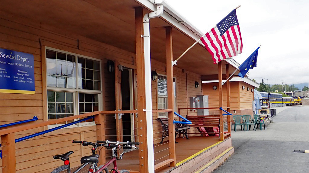
When we finally arrived back at sea level at the Seward Station and after collecting our backpacks we hiked the last several miles into town and our hotel. In the coming days we were looking forward to hiking the extensive trail system at Caines Head State Recreation Area and exploring the magical waterways of Kenai Fjords National Park.


 “Travel is fatal to prejudice, bigotry, and narrow-mindedness, and many of our people need it sorely on these accounts. Broad, wholesome, charitable views of men and things cannot be acquired by vegetating in one little corner of the earth all one's lifetime.” -Mark Twain


Sea Lions of Benjamin Island 2018


We frequently encounter the Steller SeaLion (Eumetopias jubatus) during our sea kayak outings along the Northwest coast. The kayak’s exceptional mobility and stealth provides an excellent opportunity to observe and study their behavior, both in the waters around us, and occasionally when they hall out to rest on ancient slabs of rock at water’s edge.


From a secluded harbor we paddled for several hours, first along a rocky forested coastline, then around the sandy fringes of an expansive delta, and after a short offshore crossing arrived at the southeastern end of Benjamin Island.


The much older Tlingit name for the island Taan X'aat'I (Sea Lion House) seemed more to the point for us, as we made our camp just inside the tree line. From here our plans included hiking around to the other side of the island and observing the Sea Lions from the cliffs above.


It was early spring and the rainforest undergrowth was just wakening up from winter’s slumber when we arrived. Luckily steady cold breezes from the ocean worked in our favor and carried our sent away from the shoreline. Moving quietly we followed game trails along the parameter of the island that slowly rose in elevation to overhanging cliffs and rocks on the western side.  


We moved forward to the edge of the rocks slowly in order to not alert the Sea Lions to our presence or otherwise change their behavior. From our concealment we were able to photograph and video the colony below undetected. We sat on our perch and observed their interactions, looking to capture with our cameras moments of social relationships between individual Sea lions.


When it came to who’s who on the hall out the biggest bulls had the best situated slabs of rock and plenty of room to lounge about, they also enjoyed their pick of the females. All other potential suitors or interlopers will have to fight for the privilege. This battle hardened champion’s face and neck bore the scars of many such encounters.    


Steller Sea Lions together are a gregarious and rowdy bunch, and their shoving and bellowing created a near constant ruckus as returning individuals arrived in search of family members and a spot to relax. Hard to believe that any of them gets much rest, but all this jostling about no doubt reinforces social bonds and hierarchy within the group.   


For us it was a privilege to visit the house of the Sea Lion and to observe first hand their remarkable lives on the island’s rocky shore. Before we left we circled the island in our kayaks making sure to stay well clear of the hall out (100 yards). At that distance we did not seem to affect their behavior so we stopped to admire them from a water level view.


 Continuing on around the island we stopped for snacks on a nearby smaller Island and gazed back towards Benjamin Island and surrounding coastline. Standing there on the pebbly beach we contemplated how fortunate we were that these natural treasures had been wisely protected for all of us to enjoy, Sea Lions included. 

“What speaks to the soul, escapes our measurements.” ― Alexander von Humboldt


Alaska Railroad’s Aurora Train, Fall 2017

Since my destination was located within easy walking distance I checked out of my hotel and in the early morning hours made my way on foot down to the iconic Alaska Railroad depot. I sorta hated to leave, I was enjoying the Historic Anchorage Hotel’s quirky architectural details and turn of the century décor, but I would be back there again in two days. 


The Alaska Railroad’sAurora Train travels in the winter months between Anchorage and Fairbanks leavening every Saturday and then returning the following day, a journey of 356 miles one way that would that take approximately 12 hours. During its course the train passed over a vast expanse of northern boreal forest, up and around several mountain ranges and connected a number of small isolated Alaskan communities. When I got my boarding pass at the ticket window I was given a small map of the route ahead. 


Power for our journey was supplied by two SD70MAC diesel locomotives, number 4324 and 4320 respectively, both were manufactured by GM Electro-Motive Division and were pulling a kitchen car, a dining car, a snack and lounge car, two passenger seating cars and a luggage/freight car.  The Aurora travels the same stretch of tracks as the railroad’s better known and slightly more luxurious Denali Star, but on this outing the views of the passing scenery were none the less first class. Nature’s palette in Alaska is always changing from the luxuriant greens of summer to the fiery colors of fall and then inevitably by the snowy whites of winter. And in the darkening winter skies landscapes can become hauntingly illuminated by the swirling colors of the Aurora Borealis that gives this locomotive its name.


Curious as to the history of the railroad and its economic impact on Alaska I gathered some information while waiting at the station. A small booklet from the gift store provided a brief outline of the company’s evolution over the years. In 1903 the first 50 miles of tracks were laid north from the territorial settlement of Seward, then in 1914 the US Congress provided funding for construction of the line all the way to Fairbanks. Carving this route through the wilderness lasted until 1923, but although the tracks had been laid the company’s continued development was limited by Alaska’s small population. World War II brought substantial profits from hauling military and civilian supplies and materials and two tunnels were built through the Chugach Mountains to allow rail access to the strategic port of Whittier. After the war passenger service was expanded and the company shifted to diesel locomotives. The company survived the Good Friday earthquake of 1964 despite extensive damage and in the 70s was instrumental in hauling supplies for the oil pipeline project but financially the railroad continued to struggle. So in 1983 the railroad partnered with the State of Alaska and under this public/private charter overall service and infrastructure was greatly improved. By the late 90s the corporation was back in the black and business was expanding. Today, according to some well-placed sources I talked to, the corporation is doing well and passenger service is now second only to hauling gravel as the company’s primary revenue source.

Built in 1942 the Anchorage train station typifies mid twentieth century architecture as fireproof concreate and steel replaced wooden structures in the last frontier. Though not particularly ornate, this building, due to its historic importance to Alaskan transportation, is now on the National Register of Historic Places.


Our train crept slowly across the Hurricane Gulch Bridge in the early morning light. Our conductor informed us that this was both the longest and tallest bridge on the entire railroad, a breathtaking 254 feet above Hurricane Creek. Passengers craned their necks to peer into the chasm below.


The rail line north to Fairbanks closely follows four major Alaskan rivers, the Matanuska and the Susitna Rivers that flow south into Cook Inlet and the Pacific Ocean, and to the north the Nenana and Tanana Rivers that complete their journey in the Bering Sea. These wide braided rivers carry rocks, sand and silt ground down by the glaciers of the Alaska Range and create the soils and hydrology necessary for these extensive deciduous forests. Though not at their peak the late fall colors along this stretch of the Susitna were still quite vibrant.  


The train passed through several types of ecological zones during the course of our journey. Changes in elevation and eventually latitude were noted by changing plant and animal groups. Slightly less obvious were plant cover variations that had been caused by fire (pyro-diversity) and it was interesting to try and guess the last time any given area we were passing through had burned. As we passed Summit Lake where high elevation and winter storms determined the ecology we were informed that Broad Pass between the Talkeetna Mountains and the Alaska Range was also the top of the watershed. From here on all waters we would travel along would be flowing north to join the Yukon River.


The Aurora Train has few scheduled stops along the way but passengers can disembark at prearranged “whistle stops” or can be boarded by “flagging” the train along various parts of the route. This is the only railroad in the US that still offers this kind of flag stop service to rural residence. And while there were a few rugged individuals loaded with hunting and wilderness supplies that got on and off along the way the vast majority of the passengers on this train were heading north with a very different agenda.  


With the train packed to capacity most of my fellow passengers were visiting from Asia, where it is a popular belief that a child conceived under the northern lights would have special powers and good fortune. When we finally arrived at the Fairbanks Station, with no other luggage other than my backpack, I sprinted for a cab. At the hotel the front desk staff asks us if we would like an “aurora wakeup call”, I opted out, but wished the young folks the best in their endeavors. I however needed my sleep, tomorrow, early, I had a train to catch.


“Travel changes you. As you move through this life and this world you change things slightly, you leave marks behind, however small. And in return, life—and travel—leaves marks on you.” ― Anthony Bourdain


Point Couverden to Saint James Bay 2016

Its official, May is the new June, and as winter loosened its grip even earlier this spring the plants and animals of the southeastern Alaskan rainforest were beginning to adjust to a warming environment, how much so we had been interested to see. What species would possibly benefit from a milder winter and which ones might have difficulty? This year’s sea kayaking expedition from Point Couverden to Saint James Bay, west of Juneau Alaska, took us through a verity of coastal features that allowed us to observe how the myriad of life forms in the intertidal, estuarine and near shore rainforest were coping with this new change in climate.


To save time we chartered a boat to drop us off on a small cluster of connected islands located on the eastern side of the Couverden archipelago. We set up our base camp in the woods adjacent a well protected beach and from this central location we were able to explore the surrounding islands and bays unencumbered by the additional weight of our camping gear.


The Couverden Islands are, geologically speaking, the trailing end of the Chilkat Mountains as they plunge into the sea. Located at the crossroads of three major fjords, Chatham Strait to the south, Icy Strait from the west and Lynn Canal stretching northward, their outer shores are beset by strong tides and weather systems. But their inside waters, protected by outlying rocks and islands, were often quite calm and serine, perfect for closely observing the natural world from a kayak.


Our first outing was to explore a series of smaller islands that bordered the western edge of Lynn Canal. Alaskan maps and charts are often limited in feature names so we decided to call this group of islands the “Lynn Islands” and numbered them 1 through 9 on our map. As we approached “Lynn Island # 5” we were impressed by its steep sides and wave sculpted features.


Our seashore observations were not entirely without purpose, we had been asked to conduct a survey of sea star health for UCSC’s Pacific Rocky Intertidal Monitoring group. Sea star populations have had a significant decline in the Northwest due to a mysterious wasting disease. A calm sea and an extremely low tidal cycle allowed us to document the health of a verity species of sea stars. Thankfully the vast majority we observed were in good health, like this Sunflower Sea Star (Pycnopodia helianthoides).


Throughout the week fair winds and calm seas continued and allowed us to explore the coastlines of Couverden, Ansley & Entrance islands. The area was rich in wildlife both above and below the waves. The islands strategic location made the surrounding protected waters an attractive stopover for migratory birds. Deer, moose and brown bear were observed in shoreline sedge meadows. Humpback whales were often seen in the adjoining bays and channels. And the extensive intertidal areas surrounding the islands were home to many species that we had not had the opportunity to observe before.


While exploring the lagoon in the center of Couverden Island Brenda exclaimed that “a three foot long sea centipede just surfaced next to my kayak”. She tried briefly to describe it but it did not sound like anything I had seen before, too bad I thought we’ll probably never see that again. Surprisingly however in circling the lagoon we were able to observe several dozen more surfacing and diving in the shallow waters. Oddly enough though, when we returned to camp we were unable to find anything in our guidebook that resembled what we had seen. Needless to say this became the topic of much idle speculation during the rest of the expedition. It wasn’t until we returned home and sought advice from several experts that we learned it was a Polychaeta called the Giant Clam Worm (Alitta brandti). What a fascinating creature!


Much as we enjoyed our week in the Couverdens fair winds and a favorable tide enticed us to pick up camp and continue north along the western shores of Lynn Canal. Along the way the exceptionally clear skies afforded us grand views of the Coast Mountains to the east. Even the resident Eagles seemed to be enchanted by their towering pinnacles.


Broad sandy beaches became more common, enticing us to stop rest and explore upland. We eventually decided on an elevated sandbar under Mount Golub to make camp and spend the night.  Next morning, when we were packing up to leave, the surrounding scenery made us wish we could have stayed a little longer.


Large cruise ships would pass us by on their way down from Skagway. Our camp food on long expeditions can be rather “basic” so we tortured ourselves by speculating what gourmet delicacies their passengers might be dinning on.


Arriving at Saint James Bay we set up another centrally located camp and spent the next several days exploring its coastlines and estuaries. Protected from the strong north-south winds of the fjord it proved to be another great location to survey sea stars and take in the surrounding scenery.


On the northeastern side of the bay we hiked a short trail that crossed over to Boat Harbor, a deep lagoon that is a popular refuge for small boats fishing in Lynn Canal. Along the way we spied this rare and beautiful Calypso Orchid growing in the shadowed rainforest, perhaps another beneficiary of the warmer spring weather.


During high tides we paddled as far as we could up into the river estuaries to watch groups of migratory birds feed in the muddy shallows. Farther up, as the river channels narrowed, we found ourselves surrounded by a perfusion of fragrant wildflowers that had just begun to emerge in upper sedges meadows.


After leaving Saint James bay we backtracked a little to a rocky point called the Lynn Sisters to make camp near the shortest and least exposed crossing when returning to Juneau.


We listened to the weather forecast to pick the best day and time to cross Lynn Canal. The serene setting of our early morning launch seemed to promise an easy passage, but it was not to be. Half way across the wind and waves picked up and once again reminded us of the folly of trying to predict the weather in southeast Alaska. 


“Climate is what we expect, weather is what we get” -Mark Twain


Alsek River Raft Trip 2015

The Alsek River starts its 240 mile (390 km) journey in Canada’s southern Yukon before carving its way through the high coastal mountains of British Columba and Alaska to eventually empty into Dry Bay and the Gulf of Alaska. It is a wild and untamed river that had captured my imagination for years. With Art otherwise occupied it seemed a perfect opportunity for me to arrange a rafting trip to experience the river firsthand and observe and explore some of the vast wilderness that surrounds it.


When it came to choosing an outfitter Chilkat Guides Ltd was an easy choice. Locally owned, they had over three decades of experience rafting in Alaska and on the Alsek River. After meeting up with our guides in Haines Alaska we drove north crossing the US / Canadian border to the village of Haines Junction in the Yukon. From there north along the ALCAN Highway to a turnoff at Bear Creek and a dirt road that paralleled the Dezadeash River, a tributary of the Alsek, that was our final point of departure for the expedition.


The Dezadeash River was broad and flat with little currant to move us downriver additionally strong winds coming down out of the mountains brought progress almost to a standstill. Rafts were lashed end to end to help maintain course and make better headway. After some strenuous paddling we finally stopped for lunch where the Kaskawlish River joined the Dezadeash to form the swifter flowing Alsek. Continuing on the winds persisted well into the afternoon kicking up annoying dust storms from the surrounding sandbars.


From our second camp we hiked up Goat Herd Mountain to a ridge covered in wild flowers to view the Lowell Glacier flowing down from the Saint EliasMountain Range. 


Our guides were astonishingly good cooks, with a fully stocked kitchen and Dutch ovens for cooking, every meal was a multicourse feast. Their culinary skills lifted everyone’s spirits and provided a perfect opportunity to relax and discuss the day’s adventures.    


Camp four was situated just above Turnback Canyon a steep and narrow section of the river that was unrunnable in our rafts. Shortly after we had arrived we were visited by a large male Brown Bear and we all got together to bang on pots and pans to persuade him to leave us alone. Initially he seemed unimpressed but eventually he sauntered off. Later we hiked a short ways along the side of the canyon and visited the memorial to Walt Blackadar, who at the age of 49 made the first solo kayak journey down this treacherous stretch of river.


The helicopter arrived to portage us around to the other side and on the ride over we had grand views of the sprawling terminus of the Tweedsmuir Glacier. It was the foot of this enormous glacier, pushing up rock and gravel that had narrowed the canyon walls and created the lethal set of rapids that had made this stretch of the river infamous.


After everyone had been safely transported downstream the helicopter brought our rafts and gear slung underneath by a cable. When it arrived we all worked together to re-inflate the rafts and load the gear.


It felt good to be underway again watching the mountains and landscape drift slowly by, nothing but the grandeur of nature for as far as the eye could see. During its run to the ocean the Alsek passes through three sizable national and provincial parks making it one of the largest contagious park systems in the world. The KluaneNational Park and Reserve in the Yukon, the Tatshenshini-Alsek Park in British Columbia and Glacier Bay National Park in Alaska. 


Not surprisingly the Alsek and its tributaries are also listed as a UNESCO World Heritage Site, so the other nations of the world have an interest in this area too. It warmed my heart reflecting that the beauty of this river will be protected for generations to come.


After passing the Alaska border the river entered Alsek Lake that was choked with ice bergs from the Alsek Glacier and other smaller glaciers that flowed into it. After our guides scouted the way ahead from a small rise we wove our way through the labyrinth of ice to make camp along the lakes chilly shoreline. During the night a huge berg rolled over sending a series of large waves across the lake and depositing chunks of ice high up onto the beach, much to our astonishment the following morning.  


The next day when we finally got clear of the larger bergs the clouds briefly lifted reviling the surrounding mountains of Glacier Bay National Park and at one point even the lofty summit of Mount Fairweather, at 15,325 feet, far in the distance. 


Eventually the river slowed and eased into Dry Bay a large estuary and protected inlet located on the Gulf of Alaska.


Slowly a few signs of human existence came into view.  At our take out location an ATV with a flatbed trailer was there to meet us and carry our bags to a gravel landing strip for an airplane flight up the coast to the village of Yakutat Alaska, and from there to a commercial flight to take us back home.  


Adventure is worthwhile in itself. -Amelia Earhart